Our Mission: Environmental Prediction Science
As climate change becomes a global challenge, understanding and predicting the behavior of the Earth's atmosphere, oceans, and terrestrial water cycle is a critical mission for modern science. Our laboratory aims to contribute to solving societal challenges—such as mitigating weather-related disasters and adapting to climate change—by developing advanced environmental prediction technologies that integrate Earth observation data with information science. For prediction, we employ numerical simulations using supercomputers as well as machine learning techniques. To integrate observations with predictions, we utilize statistical and mathematical methods represented by data assimilation. By combining Earth environmental big data with advanced data science techniques, we seek to create a new paradigm for next-generation Earth system prediction.
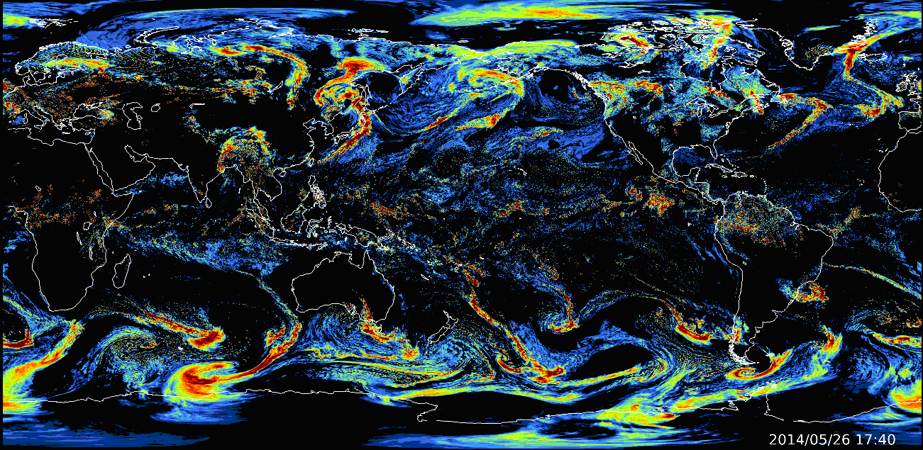 A global precipitation forecast using the Nonhydrostatic ICosahedral Atmospheric Model NICAM
Predicting Global Weather-related Disasters
In recent years, extreme weather events have become a global concern. Improving the accuracy of weather forecasting is therefore essential for maintaining a safe and sustainable environment for human society. Our laboratory is developing a global weather forecasting system that combines rapidly advancing artificial intelligence (AI) with data assimilation, leveraging large-scale Earth environmental data. In addition, we are working on a qualitative transformation of weather prediction using generative AI. For example, our scenery prediction system BAECAST predicts the actual landscapes that may appear under those conditions. This approach allows people to imagine future weather more intuitively. By utilizing generative AI technologies, we aim to significantly advance the conventional framework of weather prediction and establish a new paradigm of weather prediction co-created with society.
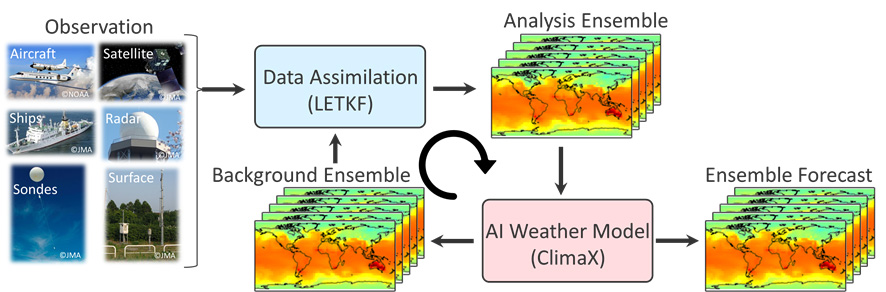
AI–Data Assimilation Coupled System for Global Weather Prediction Developed in Our Laboratory
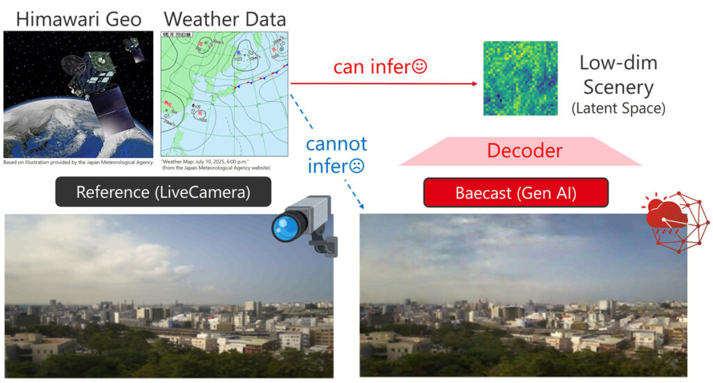
BAECAST: A Generative AI-Based Scenery Prediction System
Our mission: A World Beyond Predictions
The guiding philosophy of our laboratory is built upon three pillars: science, society, and education. We aim to develop innovative Earth environmental prediction technologies, and to promote practical social implementation related to disaster prevention through collaboration with academia, industry, and government. As part of Japan’s Moonshot Goals promoted by the Cabinet Office, we are also engaged in highly ambitious research on weather control. We have already initiated weather modification and cloud seeding experiments, and are developing a digital twin that integrates various remote sensing datasets. Through these efforts, we continue to work toward the realization of weather control technologies.
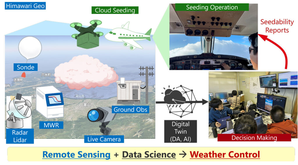
Weather Control Digital Twin Developed in the Moonshot Goal 8 Program